How Long Is The Burlington Bike Path?
The Burlington Bike Path runs about 8 paved miles along the lakefront, and the Island Line Trail continues to 14.4 miles total. Distances, surface, riding time and where to stay.
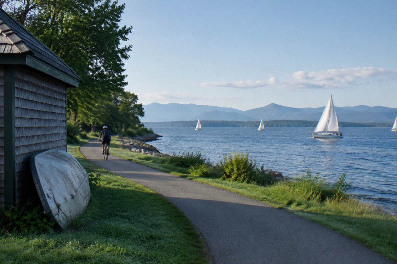
The Burlington Bike Path measures about 8 miles of paved greenway running the length of the city's lakefront, from Oakledge Park in the south to the Winooski River line at the north end. Ride past that point and you are on the Island Line Trail, which stretches the full journey to South Hero to 14.4 miles, including roughly 5 miles of crushed gravel on the Colchester Causeway. The path is flat nearly the whole way, built on old rail bed, and most cyclists cover the paved section in well under an hour. If you're wondering how the rest of the city treats riders once you leave the waterfront, our guide to cycling in Burlington covers rentals, e-bike rules, and a few spots that call for extra care.
That is the short answer, but the interesting part of this ride is how the numbers stack up segment by segment, and how one narrow gravel causeway turns a short city cruise into one of the most distinctive bike rides in New England. This page covers the length, the endpoints, the surface, and realistic riding times; the wider routing and rental picture lives in the Burlington Bike Path guide.
Path Length And Key Facts
The Burlington Bike Path, also called the Burlington Greenway, runs about 8 miles end to end along the city's Lake Champlain waterfront. It is fully paved and almost perfectly flat, following an old rail corridor, so a steady cyclist can ride its full length in roughly 40 minutes to an hour. Counting the connecting Island Line Trail through Colchester and across the causeway, the whole route to South Hero reaches 14.4 miles.
The 8 mile figure is the one to anchor on when someone asks about the path by name. That paved greenway is Burlington's own segment, hugging the shore from the suburban parkland at the south end through the busy waterfront downtown and north toward the Winooski delta. It behaves like a linear park: wide, well used, and punctuated by beaches, parks and docks rather than road crossings.
The 14.4 mile figure answers a different question. The Island Line Trail is the larger route the path feeds into, and it is the number riders should plan around if the causeway is on the itinerary. Crossing a former rail causeway over open lake, with water on both sides, is the reason many visitors ride out here at all, and it sits at the far end of the combined mileage.
Riders consistently describe the surface as the easy part of the day. Eight paved miles, then a short stretch through Colchester, then compacted gravel wide enough for two abreast. Nothing on the route demands a mountain bike; a hybrid, a fitness bike or a Class 1 pedal-assist e-bike all work, and e-bikes of that class are permitted wherever bicycles are allowed on the greenway and Island Line.
Where Does The Burlington Bike Path Start And End?
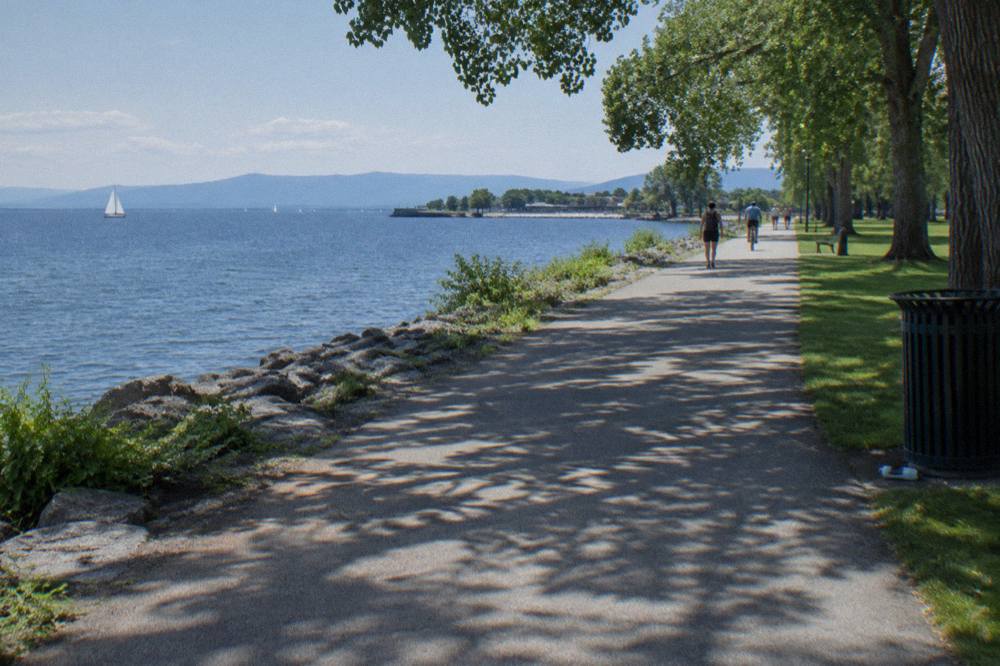
The paved Burlington Greenway starts at Oakledge Park on the southern lakefront and runs about 8 miles north, ending where the corridor leaves the city near the Winooski River. From there the Island Line Trail continues through Colchester and across the Colchester Causeway to a landing point in South Hero, for the full 14.4 mile distance.
At the southern end, Oakledge Park gives riders parking, water in season and a calm start through residential shoreline. The middle miles pass through the heart of the waterfront: Waterfront Park, the boathouse, the ferry docks and the ECHO science center sit directly on or beside the path, which is why this stretch carries the heaviest foot traffic and the slowest riding.
North of downtown the path quiets down. It skirts North Beach and passes through the Intervale lowlands toward the Winooski line, and here the ride starts to feel less like an urban promenade and more like a genuine bike route. The transition into Colchester is where pavement eventually gives way to the crushed gravel of the causeway segment.
The South Hero end is deliberately rustic. The trail lands at an old rail point on the island, and the customary celebration is pie at the orchard a short ride up the road, a tradition strong enough that riders talk about the trip as a pie ride as much as a bike ride. Return the way you came, or plan the shuttle question before setting out.
How Long Does It Take To Ride The Full Route?
Most cyclists ride the 8 mile paved Burlington Bike Path in 40 minutes to an hour at a relaxed pace, allowing for pedestrians near the waterfront. Riding the full 14.4 mile Island Line route to South Hero and back typically fills about two hours of pedaling and stopping, since the gravel causeway slows most riders and the turnaround deserves time. E-bike riders move faster but rarely finish much sooner, because the causeway invites stopping.
Time estimates for this route are dominated by surface and crowd, not climbing. There is effectively no climbing. The gradient stays under rail-trail grades the whole way, which is why families with children and riders on heavy rental bikes make up a large share of the traffic on weekend afternoons.
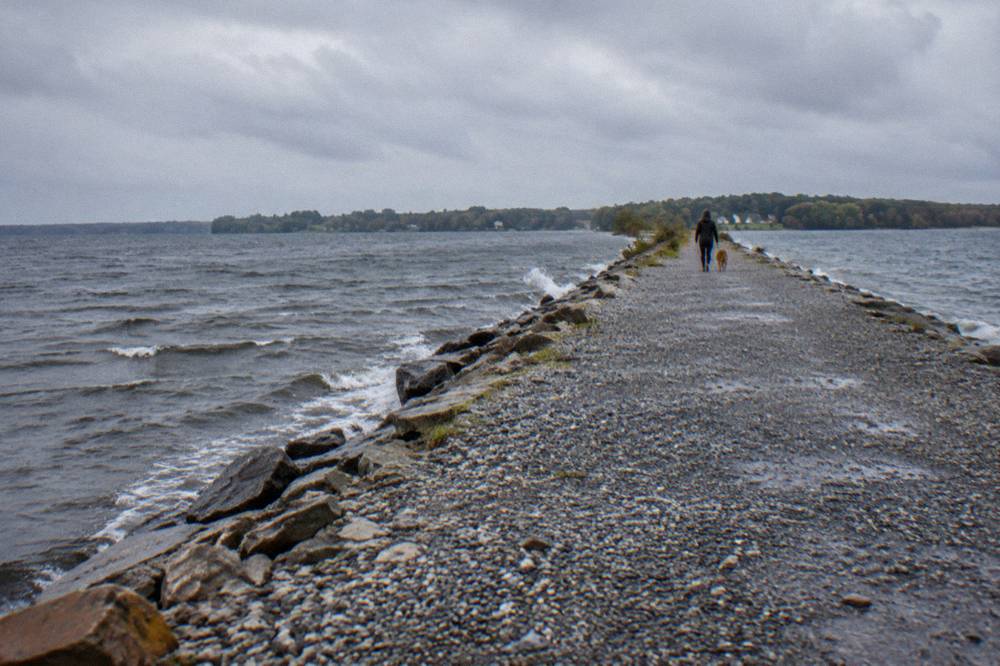
The gravel deserves respect in planning. Roughly 5 miles of the Colchester Causeway segment is crushed stone, rideable on any bike with reasonable tires but noticeably slower than pavement, and on windy days the exposed lake crossing adds effort in both directions. Riders on narrow road tires report it is doable and jittery; riders on hybrids report no trouble at all.
Is The Burlington Bike Path Flat?
Yes, the route is flat essentially end to end. It is built on a former rail corridor, so grades stay gentle throughout the 14.4 miles, and the paved 8 mile segment in particular has no meaningful climbs. The only handling challenge is the crushed gravel surface of the Colchester Causeway, roughly 5 miles of it, which rewards slightly wider tires and steady attention.
Rail corridors make for honest flat riding because trains could not climb much either. Riders moving from the paved city segment onto the causeway gravel sometimes feel the difference in their hands more than their legs: the stone is firm and compacted, but it hums and shifts a little under skinny tires. Almost any bike manages it.
This flatness is the route's quiet selling point for mixed groups. A rider who has not been on a bike in years, a teenager on a borrowed hybrid and a training-focused cyclist can all ride the same path on the same morning and each get a satisfactory loop out of it, which few routes in Vermont can claim. Mountain country starts east of here.
Do You Need The Bike Ferry To Ride The Whole Thing?
Yes, to reach South Hero riders must cross a channel gap in the Colchester Causeway, and the seasonal bike ferry run by Local Motion is the way across. Its season runs late May to mid October, with reduced weekend schedules in fall. The ferry is donation based, with five dollars suggested one way, and it is closed for the current season, returning in May.
The gap is small but absolute: a cut in the causeway where a moveable bridge once stood, with open lake on either side. When the ferry runs, it shuttles bikes and riders across in minutes and the ride continues to South Hero. When it does not run, the causeway is an out-and-back with a spectacular dead end, and riders should plan for that before pedaling out.
Checking the schedule costs nothing. The operator's ferry page carries the current operating calendar and details, and mid-week riders in September and October in particular should confirm rather than assume, because the fall schedule narrows to weekends. Details on timing and how the crossing works are gathered in the bike ferry schedule article, and the crossing sits inside the broader Colchester Causeway and Champlain Islands ride.
What Kind Of Bike Suits The Distance?
For the 8 paved miles, any bike works: road, hybrid, city, kids bike or Class 1 e-bike. For the full 14.4 mile Island Line route, the best choice is a hybrid or gravel bike with tires wider than a road race bike's, because the roughly 5 miles of causeway gravel reward a little volume and tread. Skinny road tires cope, but they make the crossing nervous rather than fun.
Rental riders rarely need to overthink this, since the shops around the waterfront stock exactly the bike the route wants. E-bike riders should know the class rules before choosing: Class 1 pedal-assist bikes are allowed wherever bicycles go on this route, while e-motos and motorcycle-style machines are prohibited. That maps onto state rules too, and the details are laid out in the Vermont e-bike and helmet rules guide.
Families should budget time, not gearing. Kids on 20 inch wheels ride the paved segment happily and find the gravel a novelty for the first mile, so a common pattern is to ride the greenway with children and save the causeway crossing for an adults-only morning. Other pages covering the same trip are gathered on Vermont Biking Tours.
Where Can You Rent A Bike For The Ride?
The main rental point is the Local Motion Trailside Center at 1 Steele Street in Burlington, sitting directly on the path. It rents conventional bikes, Class 1 pedal-assist e-bikes, adaptive cycles and kids bikes, is open daily from 9am to 6pm, and recommends reservations. Rental prices change, so check the shop directly rather than trusting a cached figure. For a fuller look at other rental spots around town, including hotel bike programs and e-bike rules, see our guide to renting bikes for the Burlington Bike Path.
Having the rental operation physically on the trail removes the whole logistics question: no roof rack, no parking puzzle with a borrowed bike, just show up, fit the bike and roll. The center operates as part of a nonprofit, and rental proceeds support its advocacy work on biking and walking in the state.
Local Motion also runs the ferry, so the same organization bookends the ride: the bike you rent at the start and the boat that carries you over the gap at the far end. Its main site covers both, and the where to rent bikes for the path article goes deeper on options.
| Route segment | Distance | Surface | Typical riding time |
|---|---|---|---|
| Burlington Greenway (the Bike Path proper) | About 8 miles | Paved, flat | 40 to 60 minutes one way |
| Colchester connector and causeway | Roughly 5 miles | Compacted crushed gravel | 30 to 50 minutes one way |
| Causeway landing to South Hero point | Remainder of route | Gravel and short road links | 15 to 25 minutes one way |
| Full Island Line, Burlington to South Hero | 14.4 miles | Paved and gravel mix | About an hour to an hour and a quarter one way |
Where Should You Stay To Ride The Path?
The ride works best from a base on or near the waterfront, because the path's southern two thirds are within a short walk of the downtown lakefront hotels. Two Burlington properties sit close enough that the bike ride starts the moment you step outside: Hotel Champlain Burlington, steps from Waterfront Park and the path access, and Hotel Vermont, about two tenths of a mile from the Burlington Bike Path in the lake-side downtown.
The Hotel Champlain Burlington places riders steps from Waterfront Park and its bike path access, and its listing includes free bicycle rentals for guests, which covers the "arrive without a bike" problem entirely. From the front door, the 8 paved miles open in both directions: the downtown waterfront southbound, North Beach and the Intervale northbound.
Hotel Champlain Burlington, Curio Collection by Hilton
Burlington, near Waterfront Park
Steps from Waterfront Park and the bike path access; its listing includes free bicycle rentals.
Check ratesA few blocks inland, Hotel Vermont sits about 0.2 miles from the Burlington Bike Path in the lake-side downtown, close enough that the walk to the wheels-down moment takes a few minutes. Riders who want restaurants and breweries at the end of the ride rather than at the start of it often prefer this end of downtown.
For riders pairing the waterfront with a second day in the hills, a split stay works well. Burlington for the flat lakeside miles, then Stowe for the recreation path and mountain road loops, a combination that covers both halves of what pedaling in Vermont offers. A full comparison of bases across the state is in the best towns for a bike trip roundup. And if your split stay lines up with leaf season, the best Vermont foliage towns for cyclists covers where the color and the riding overlap.
How Does The Path Connect To Longer Vermont Rides?
The Burlington Bike Path is the southern gateway to the Island Line Trail, and its northern end links Colchester and South Hero toward the Champlain Islands, a region of quiet, rolling road riding. Beyond the lake, the path is a natural pairing with the Lamoille Valley Rail Trail, the longest rail trail in New England at 95 miles from St. Johnsbury to Swanton, reachable with a short transport hop.
Riders who finish the causeway and want more have two directions to grow. The Champlain Islands themselves offer farm stands, shoreline roads and light traffic on the north side of the crossing, a classic second day for road cyclists who found the flat path too easy. Detailed routing for that continuation lives in the Island Line Trail biking guide.
The other growth path is rail trails. Vermont's rail trail network is unusually strong, from the Missisquoi Valley Rail Trail's 26.4 miles out of St. Albans to the big one, the Lamoille Valley Rail Trail, whose full length is covered in the Lamoille Valley Rail Trail biking guide. A rider who enjoys the Burlington path's rail-bed geometry can spend a week in the state without repeating a mile of it.
When Is The Best Time Of Day To Ride It?
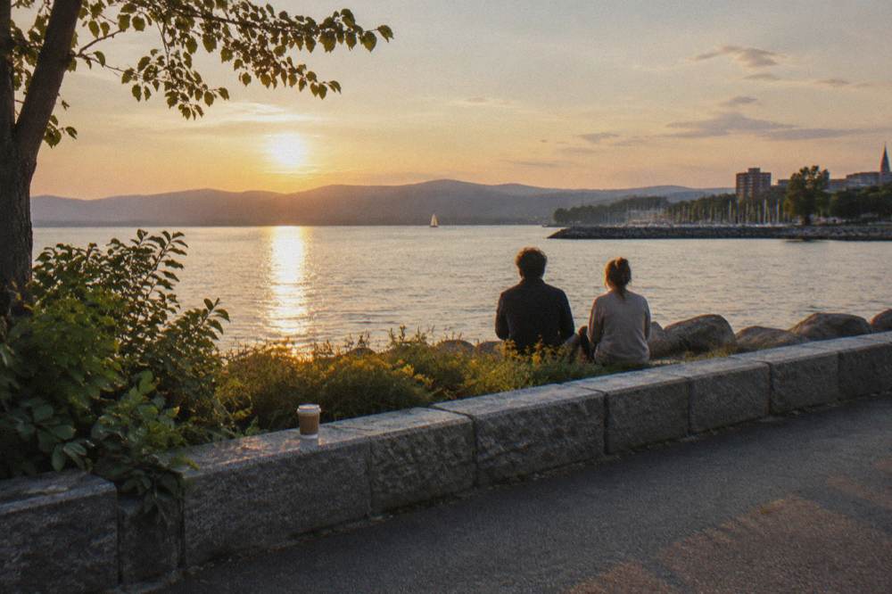
Morning, comfortably. The paved waterfront segment gets busy with pedestrians from late morning through afternoon, especially on summer weekends, and the path's etiquette slows cyclists to walking pace through the busiest blocks. An early start buys an empty path, calm lake air and a causeway crossing before the wind picks up, which it reliably does by early afternoon.
Wind matters more here than on inland routes because the causeway sits exposed on open lake. A morning ride out and a midday return often means a tailwind home, and even when it does not, the crossing is more pleasant before the whitecaps start. Riders heading for the pie stop in South Hero should still watch the clock against the ferry's operating hours.
Fall deserves a special mention. The riding window from late September to mid October coincides with foliage color along the shoreline and shorter days, with sunrise near 7 and sunset near 6:20 in early October, so a late start squeezes the round trip uncomfortably. The seasonal picture is laid out in the best time to bike in Vermont guide.
What Should You Bring For The Full 14.4 Miles?
For the paved segment, water and a normal city-riding setup suffice. For the full route to South Hero, bring more water than seems necessary, a spare tube or patch kit even on a rental, sunscreen for the exposed causeway, and layers, because lake wind changes the temperature fast. A helmet is plain common sense on a shared path regardless of any law.
The causeway is the planning pivot. There is no water, no shade and no exit along its roughly 5 gravel miles, so what you carry is what you have. Riders who turn the trip into a full day add a lock for the pie stop and cash for the ferry's donation jar, since the five dollar suggested one-way fare runs on trust and a bucket.
The packing question scales with ambition, and the site's general rundown covers the full spread from a one-hour greenway roll to a multi-day riding trip in what to bring on a Vermont bike tour. For this specific route, the honest minimum is a bottle, a tube and a windbreaker, and the honest recommendation is all three plus snacks.
Riders staying downtown can outsource some of this. Both waterfront hotels noted above sit close to the path, and a guest at either one is minutes from the rental fleet and the ride itself. For the split-stay crowd, Sun & Ski Inn And Suites in Stowe makes the second half of that Burlington-plus-hills pairing a practical base for the recreation path and the road loops around the village.
Hotel Vermont
Burlington, 0.2 miles from the Burlington Bike Path
About 0.2 miles from the Burlington Bike Path in the lake-side downtown.
Check ratesCommon Questions About The Burlington Bike Path
How Long Is The Burlington Bike Path?
About 8 miles of paved greenway along the Burlington lakefront. Extended onto the Island Line Trail through Colchester and across the causeway, the route reaches 14.4 miles total to South Hero.
Is The Burlington Bike Path Paved The Whole Way?
The Burlington Greenway segment, about 8 miles, is fully paved. The Colchester Causeway segment of the Island Line Trail, roughly 5 miles, is compacted crushed gravel that any bike with reasonable tires can handle.
Can You Bike From Burlington To South Hero?
Yes, via the Island Line Trail, 14.4 miles total, crossing the channel gap on the Colchester Causeway by the seasonal bike ferry when it runs. The ferry season runs late May to mid October with reduced fall schedules.
How Long Does The Ride Take At A Relaxed Pace?
The paved 8 mile segment takes most riders 40 to 60 minutes one way. The full route to South Hero and back typically fills about two hours, with the gravel causeway and the stops accounting for the extra time.
Are E-Bikes Allowed On The Burlington Bike Path?
Class 1 pedal-assist e-bikes are permitted wherever bicycles are allowed, including the greenway and the Island Line Trail. E-motos and motorcycles are prohibited.
Where Do You Rent Bikes For The Ride?
The Local Motion Trailside Center at 1 Steele Street in Burlington sits directly on the path and rents conventional, Class 1 e-bike, adaptive and kids bikes daily from 9am to 6pm. Reservations are recommended.