Hotel Champlain Burlington, Curio Collection by Hilton
Burlington, near Waterfront Park
Steps from Waterfront Park and the bike path access; its listing includes free bicycle rentals.
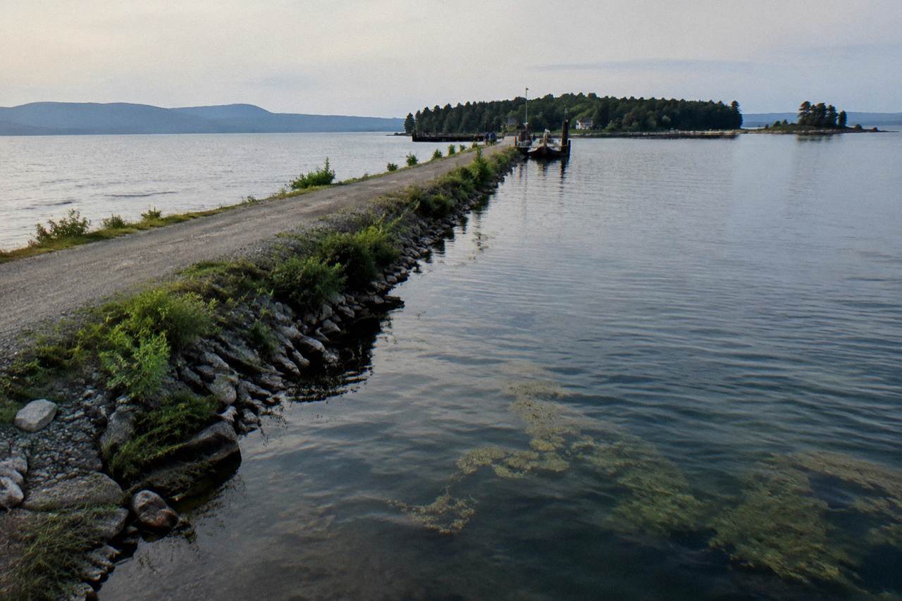
Check ratesThe Colchester Causeway runs three miles of crushed stone across open water, then a seasonal bike ferry carries riders the gap into the Champlain Islands. Here is how the route stacks up, what the ferry closure means for a ride this year, and how to plan the loop.
Short answer
The Island Line Trail runs about 14.4 miles from the Burlington waterfront to South Hero: about 8 miles paved Burlington Greenway, then roughly 5 miles of crushed gravel on the Colchester Causeway. The Local Motion bike ferry is closed for the 2026 season and returns in May 2027, so the causeway is an out-and-back until then.
The bike ferry that links the Colchester Causeway to South Hero is closed for the 2026 season, and Local Motion, the nonprofit that runs it, says service returns in May 2027. That single fact reshapes almost every plan for a Champlain Islands bike tour: instead of riding one way across the lake and looping back through the islands, most cyclists now ride the causeway as a gravel out-and-back from Burlington, or drive to the islands and ride the road loops on their own terms. Both versions are excellent, and this guide covers each.
The full Island Line Trail is about 14.4 miles from the Burlington waterfront to South Hero. Roughly 8 miles of that is paved Burlington Greenway, smooth and family-friendly, and the final stretch is around 5 miles of crushed gravel on the Colchester Causeway, a railbed riding inches above open lake on both sides. When the ferry runs, its season runs late May to mid October, donation based, with service across the cut that separates the causeway from the islands. The rides, the rentals, the roads and the places to sleep are all below.
The Island Line Trail covers about 14.4 miles end to end from the Burlington waterfront to South Hero, and most riders planning a causeway ride from downtown Burlington pedal somewhere between 16 and 25 miles round trip depending on turn-around points. The paved Burlington Greenway accounts for about 8 of those miles, while the Colchester Causeway itself adds roughly 5 miles of packed crushed stone across open water, a surface almost any bike can handle. Curious how much time the full ride takes with the ferry gap, the causeway biking time and route guide covers that in detail.
The numbers matter because they change what you bring. A road rider on narrow tires will feel the gravel section on the causeway but can ride it slowly without trouble; a family with hybrid bikes and kids will find the whole route gentle. The trail is flat essentially throughout, since it follows an old rail corridor, so distance is the only real variable in difficulty.
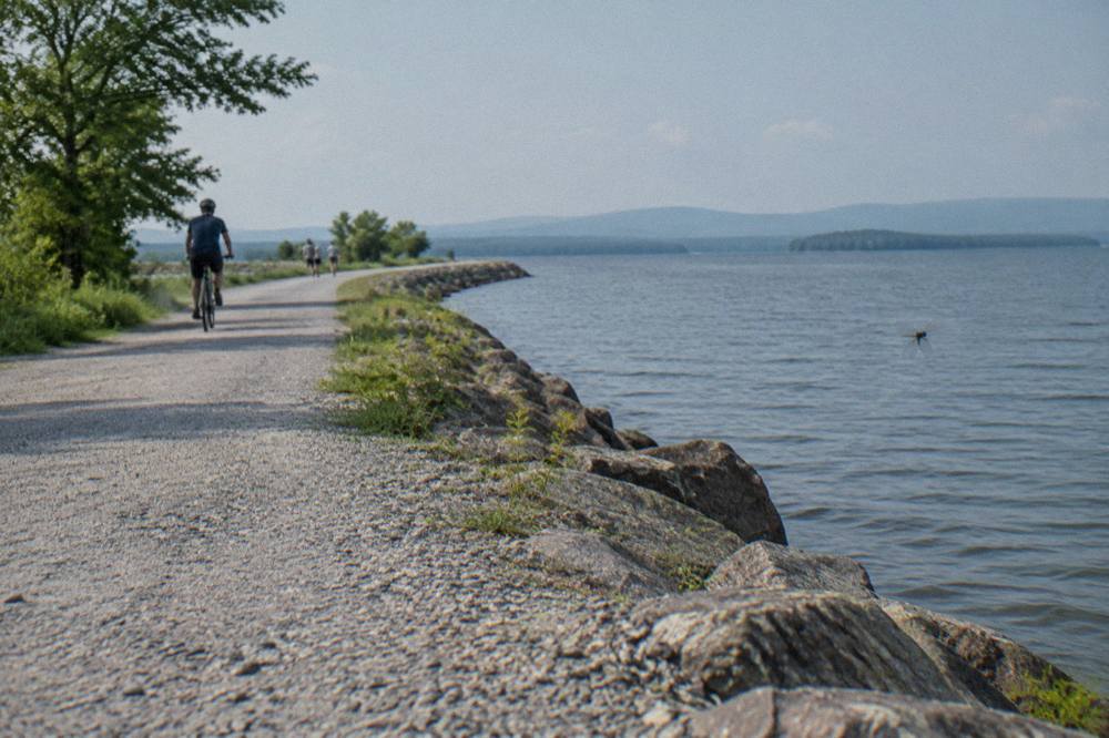
A sensible plan from downtown Burlington: ride the Greenway north through the Intervale and Colchester, roll onto the causeway at the Mills section, and ride the gravel to the trail's current end at the cut. Turn around there, stop for a swim or a picnic where the causeway widens, and coast back. Without the ferry that is a satisfying half-day ride with a lake breeze in your face in one direction and at your back in the other.
For riders who want more distance, the Missisquoi Valley Rail Trail waits farther north in Franklin County: 26.4 miles from St. Albans to Richford on a similar crushed-stone surface, joining the Lamoille Valley Rail Trail system near Sheldon. That is a different trip, but it shows how much quiet rail trail sits within a short drive of Burlington. Our overview of the long Lamoille Valley rail trail ride covers it in depth.
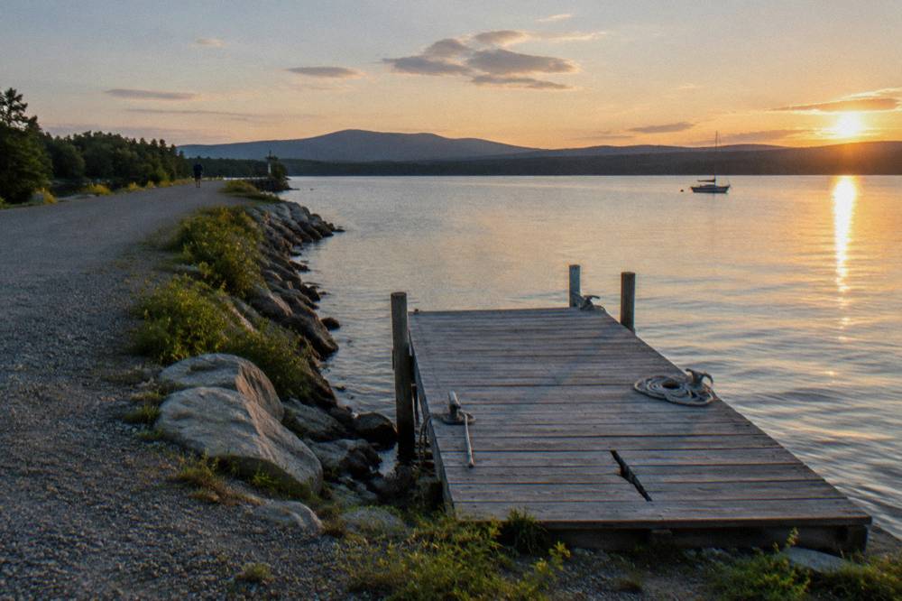
The Local Motion bike ferry across the causeway cut is closed for the 2026 season and returns in May 2027, per the operator's own page. When running, its season spans late May to mid October with donation-based crossings, and fall weekends run a reduced schedule before the final crossing. Until service resumes, the cut is the end of the line for causeway riders heading toward South Hero.
The ferry exists because a gap in the old railbed, a navigable cut through the causeway, separates the Burlington side from the Champlain Islands. When the ferry operates, crews run a pontoon boat that carries bikes and riders across; when it does not, there is no legal or safe way across the open water, and riding the causeway becomes an out-and-back. The schedule is published on the Local Motion bike ferry page, which is the only source to trust for dates and hours before you plan a crossing.
Two practical points follow. First, if your Champlain Islands bike tour lands in the shoulder season, do not build the itinerary around a ferry link that may be running weekends only or not at all. Second, the causeway is still worth the ride even without the crossing: the gravel section over open lake is the most dramatic rail trail scenery in the region, and riders report consistently good conditions on the main path.
| Route fact | Figure | Notes |
|---|---|---|
| Island Line Trail, total | About 14.4 miles | Burlington waterfront to South Hero |
| Burlington Greenway segment | About 8 miles | Paved multi-use path |
| Colchester Causeway segment | Roughly 5 miles | Crushed gravel railbed over open water |
| Ferry across the cut | Closed for 2026 | Returns May 2027 per Local Motion |
| Typical ferry season | Late May to mid October | Donation based when running |
Yes, but by road rather than rail trail. Cyclists reach the Champlain Islands by driving to South Hero, Grand Isle or North Hero and riding the island road loops, or by riding rural roads north from Burlington through Colchester and crossing on US 2, a busier highway segment most riders avoid with children. The islands reward the effort with quiet farm roads and constant lake views.
The island loops are the part of a Champlain Islands bike tour that Vermont cyclists keep to themselves. Route 2 strings the islands together, but the riding worth planning sits on the side roads: Apple Point Road and the lanes around Lake Champlain's western shore in South Hero, the Grand Isle back roads, and the long quiet stretches of North Hero. Traffic thins as you go north, and the terrain stays gently rolling throughout.
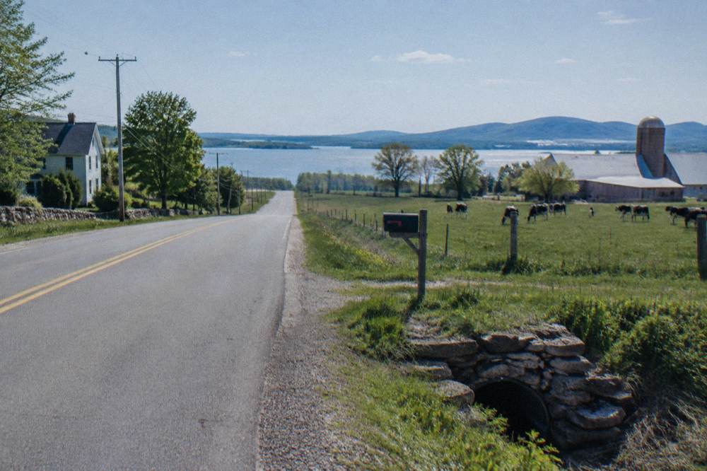
Plan around wind more than hills. The islands sit in the middle of the lake basin, and a strong west wind turns a flat 25 mile loop into a grinder on the exposed stretches. Morning riding tends to be calmer, and the farm stands that line the roads in summer make natural rest stops, several of them clustered on South Hero, where cyclists stack up buying cider and berries mid-ride. Shoulders on the busier connectors are narrow, which is standard for Vermont secondary roads, so ride defensively and single file where the road tightens.
E-bike riders have it easy here. Class 1 pedal-assist e-bikes are permitted where bicycles are allowed on the Greenway and Island Line corridor, and the state's three-class system treats compliant e-bikes as bicycles rather than motor vehicles. Our guide to Vermont e-bike and helmet rules spells out the details.
| Champlain Islands riding area | Character | Best for |
|---|---|---|
| South Hero side roads | Farm lanes, orchards, lake access points | Families, mixed-pace groups |
| Grand Isle loops | Rolling quiet roads, state park access | Steady road riders |
| North Hero stretches | Long, exposed, very quiet traffic | Wind-hardened cyclists |
| Causeway out-and-back | Gravel over open water, flat | Almost every rider and bike type |
Most causeway rides start at the Burlington waterfront or at trailheads in Colchester, both reachable on the paved Greenway without a car. Burlington is therefore the practical base: hotels downtown put you within a short roll of the path, and the Local Motion Trailside Center at 1 Steele Street rents bikes right on the route, so you can plan a car-free riding day entirely from a downtown base.
The waterfront start is the classic version. From near Waterfront Park the Greenway runs north, past the boathouses and the sailboats, through the Intervale and out toward the Winooski river crossing, all separated from traffic the whole way. Riders who want to shorten the pavement can drive to trailhead parking in Colchester and start closer to the gravel, which suits families hauling kids' bikes. Everything else covered here is indexed on Vermont Biking Tours.
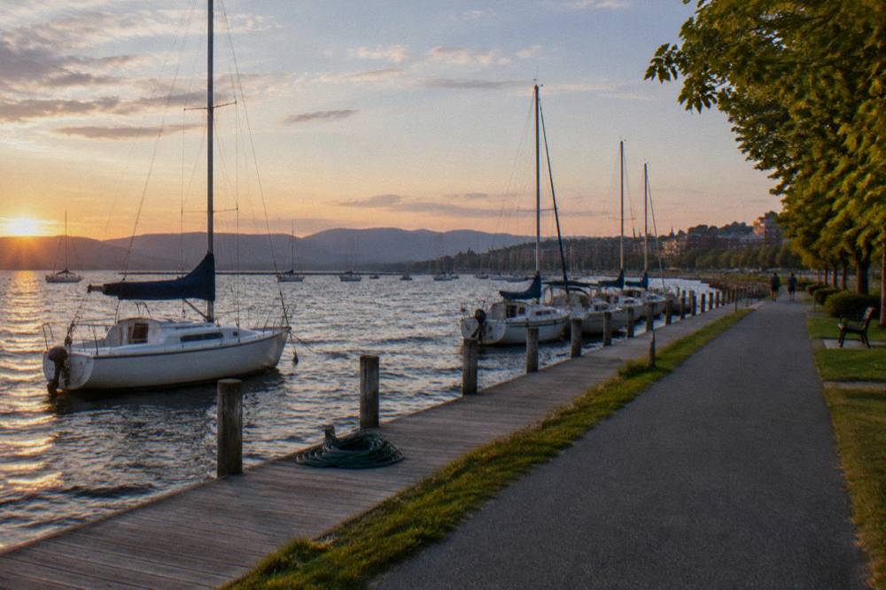
On the lodging side, two downtown properties fit the ride well. The Hotel Champlain Burlington sits steps from Waterfront Park and the bike path access, and its listing includes free bicycle rentals, which covers riders who do not want to haul their own bikes to Vermont. The Hotel Vermont is about 0.2 miles from the Burlington Bike Path in the lake-side downtown, close enough that the ride starts within minutes of the lobby.
Burlington, near Waterfront Park
Steps from Waterfront Park and the bike path access; its listing includes free bicycle rentals.
Check ratesNeither property requires a car for the riding day itself. The Greenway connects the waterfront to the causeway without a single road crossing of consequence, and food, bike shops and the Trailside Center all sit along or near the corridor. Riders extending the trip toward other Vermont riding will find more options in our piece on the best Vermont towns for a fall trip, which pairs scenery with ride access.
The Local Motion Trailside Center at 1 Steele Street in Burlington rents conventional bikes, Class 1 pedal-assist e-bikes, adaptive cycles and kids' bikes directly on the path, open daily and best reserved ahead. In the islands, rental options thin out, so most visitors rent in Burlington and ride or drive from there. Rental prices change often enough that checking the operator directly is the reliable move.
The Trailside Center doubles as the ferry operator's home base, which makes it the single most useful bike address in the region. Reservations are recommended, especially on summer weekends when the Greenway fills with visiting riders, and the rental proceeds support Local Motion's nonprofit trail and ferry work, a detail worth knowing because your rental fee funds the very causeway crossing you may ride in a future season. Details are on the Local Motion site.
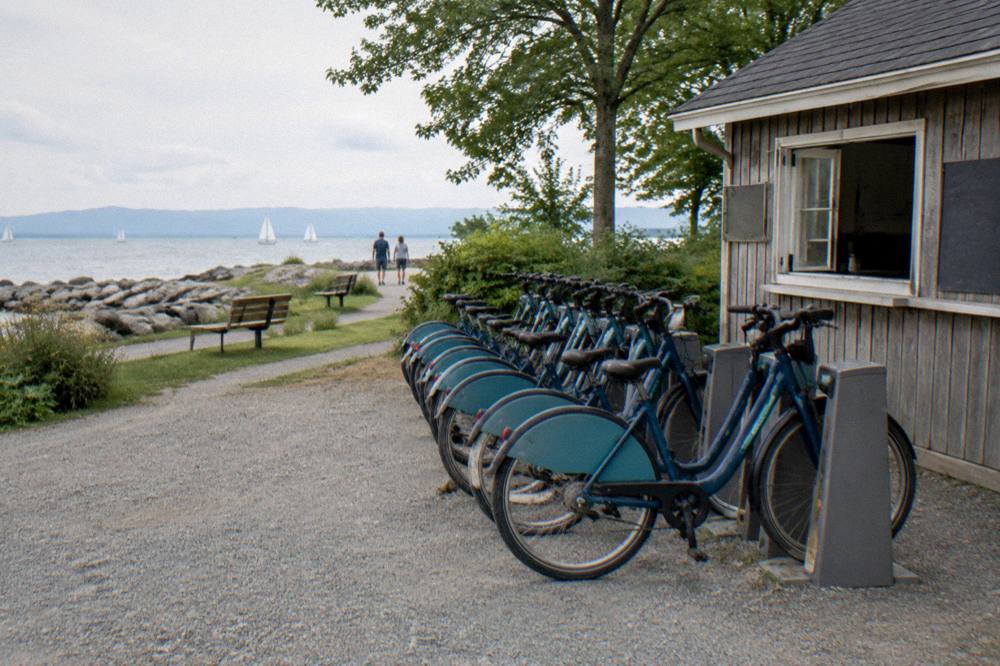
Bike choice matters less than you would think. The gravel on the causeway is packed crushed stone, firm enough that a road bike crosses it at reduced speed, while hybrids, gravel bikes and e-bikes eat it up. The one category to avoid is a pure time-trial setup with fragile tires. Our broader rundown of Vermont bike rentals covers shops in the other riding towns if your trip continues beyond Burlington.

Almost any bike works: the route is flat, the gravel is firm packed crushed stone, and daily distances stay modest. Hybrid bikes, gravel bikes, touring bikes, e-bikes and kids' bikes all handle it. Bring tubes and a pump for the gravel stretch, lights if you will ride toward dusk, and layers, because the causeway sits over open lake water and the wind chill is real even on warm afternoons.
The wind deserves its own sentence. Out on the causeway there is no tree cover and no shelter, and the wind off the lake is constant, which means a tailwind out can become a stiff headwind back with no warning but a turn in the weather. Riders report the exposed section feeling noticeably cooler than the tree-covered Greenway. A windbreaker stuffed in a jersey pocket is the single most useful piece of gear on this ride.
| Gear question | Causeway answer |
|---|---|
| Tires | Wider tires are comfortable; narrower rubber works if ridden gently |
| E-bike | Class 1 pedal-assist allowed on the corridor |
| Kids | Greenway is ideal; causeway has water on both sides, ride single file |
| Spares | Tube, pump or CO2, and a multitool for the gravel section |
| Clothing | Wind layer mandatory; lake wind blows all afternoon |
Water and food matter too. The waterfront and Colchester ends have options, but the causeway itself has nothing, no water, no bathrooms, no shade, for the length of the gravel. Carry more water than feels necessary on a warm day, and treat the causeway as a there-and-back with a fixed return point rather than a place to improvise.
Late May through June and September through mid October are the strongest windows: lake temperatures moderate the heat, summer crowds thin outside peak weekends, and in fall the Champlain valley color peaks around late September to mid October with ridgelines turning earlier and valley roads holding color later. Midweek mornings in any season give the calmest wind and the emptiest path.
Summer weekends bring the densest traffic on the Greenway, families, joggers and rollerbladers sharing the paved miles, so fast riders should plan early starts or weekday rides. Fall is the connoisseur's pick: the lake stays warm enough to soften the air, the foliage on the inland hills frames the ride, and once the leaf crowds thin after the peak, the path quiets down dramatically. Our seasonal breakdown in the best time to bike in Vermont applies directly here.
Winter riding on the corridor is possible for the properly equipped, fat bikes and studded tires, but the causeway's railbed holds ice and the wind off the frozen lake is punishing. Most cyclists treat the corridor as a three-season ride and move to groomed winter networks elsewhere, the Kingdom Trails winter operation among them, covered in our Kingdom Trails riding guide.
| Season | Causeway conditions | What to expect |
|---|---|---|
| Late spring | Open, quiet | Cool wind, occasional high water |
| Summer | Open, busiest | Full sun, lake breeze, weekend crowds on pavement |
| Early fall | Open, ideal | Foliage inland, mild air, thinner traffic post peak |
| Late fall to spring | Exposed, icy stretches | Expert fat-bike territory at best |
Yes, the Burlington Greenway half is one of the most beginner-friendly bike rides in Vermont: flat, paved, traffic-separated and punctuated with beaches and parks. The causeway gravel is also manageable for confident kids, but it has open water immediately on both sides and no exits, so families with young children should ride it single file, keep speeds down, and treat the turn-around as a fixed decision made before rolling on.
The split is roughly the Intervale. South of it, the Greenway behaves like a long waterfront park with a path through it, and a hesitant rider can bail at multiple points toward roads, shops and bus routes. North of it the corridor commits: once on the causeway proper, the only way off is the way you came, for about five gravel miles with nothing but lake on either side. That is the ride's magic and its one real planning constraint.
Beginners building toward bigger Vermont rides can use the corridor as a first rail trail before graduating to the long ones. The step-up path runs something like this: causeway out-and-back, then the Missisquoi Valley Rail Trail out of St. Albans, then multi-day plans on the Lamoille Valley Rail Trail, at 95 miles the longest rail trail in New England per the state's rail trail program at railtrails.vermont.gov. Riders curious about that progression can start with our guide to Vermont riding for beginners and seniors.
A strong single-day plan pairs the causeway out-and-back with a road loop through South Hero: ride the Greenway and causeway from the waterfront, return on the pavement, then drive to South Hero for the farm-road loop if the legs allow. A combined day of gravel and pavement suits riders who want both surfaces in one outing.
Wind, not mileage, decides the shape of the day. A calm morning favors the exposed causeway; a windy day favors the sheltered island farm roads, where hedgerows and barns break the gusts. Check the forecast for the lake basin, not just Burlington generally, and pick the half that matches.
The wind decides. A calm morning favors the causeway, since its exposure is the penalty; a windy day favors the inland shelter of the island farm roads, where hedgerows and barns break the gusts. Check the forecast for the lake basin, not just Burlington generally, and pick the half that matches. Either way, build in the food stops: the waterfront before departure, and the farm stands of South Hero mid-ride if you go that way.
Burlington, 0.2 miles from the Burlington Bike Path
About 0.2 miles from the Burlington Bike Path in the lake-side downtown.
Check ratesTiming the return matters in fall. Sunset lands near 6:20 to 6:30 in early to mid October, and the Greenway's unlit stretches get genuinely dark fast after that, so plan the last paved miles to finish with daylight to spare. Riders who overstay at a farm stand or a swim spot routinely finish in dusk traffic on the shared path, which is the most common avoidable mistake on this route.
For the second night of a two-day plan, Stowe works as a contrast base, and the Sun & Ski Inn And Suites puts you beside the Stowe Recreation Path and the village road loops for a completely different style of Vermont riding, a recreation path and mountain roads rather than lake rail trail. More on that side of the state sits in our Stowe Recreation Path riding guide, and the planning framing in how to choose a Vermont bike trip covers how these regions compare for a first visit.
Rider reports through the fall describe the main path and causeway open with no major closures. As with any long corridor, check trail status before a long ride, since flood repairs and maintenance happen season wide across Vermont trails.
You can ride the Island Line Trail from the Burlington waterfront about 14.4 miles toward South Hero, but the bike ferry across the causeway cut is closed for the 2026 season and returns in May 2027. Until then, the causeway is an out-and-back and the islands are reached by road.
It is flat railbed the whole way: about 8 miles of paved Greenway and roughly 5 miles of firm crushed gravel on the causeway. Wind off the lake is the main effort variable, not terrain, and almost any bike and rider can finish it.
The Local Motion Trailside Center at 1 Steele Street in Burlington rents conventional, Class 1 pedal-assist e-bike, adaptive and kids' bikes directly on the path, daily, with reservations recommended. Check with Local Motion for current rental prices.
The ferry season runs late May to mid October when operating, with a reduced fall weekend schedule, and it is donation based. The current season is closed; Local Motion's ferry page is the source for the return date and schedule.
Class 1 pedal-assist e-bikes are permitted where bicycles are allowed on the Greenway and Island Line corridor, while e-motos and motorcycles are prohibited. The Trailside Center's e-bike rentals are Class 1 pedal-assist for that reason.
Before you go, the pick for this guide:
Hotel Champlain Burlington, Curio Collection by Hilton
Steps from Waterfront Park and the bike path access; its listing includes free bicycle rentals.
Check rates →