Hotel Champlain Burlington, Curio Collection by Hilton
Burlington, near Waterfront Park
Steps from Waterfront Park and the bike path access; its listing includes free bicycle rentals.
Check ratesThe Burlington bike path, officially the Burlington Greenway, is an eight mile paved riding route along the Lake Champlain waterfront, and the southern gateway to the fourteen mile Island Line journey across the Colchester Causeway.
Short answer
The Burlington bike path is an eight mile paved lakeside riding route from Oakledge Park to the Winooski River line, part of the 14.4 mile Island Line corridor to South Hero. Rentals are available at the Local Motion Trailside Center on the path itself, parking sits at both ends, and Class 1 e-bikes are permitted.
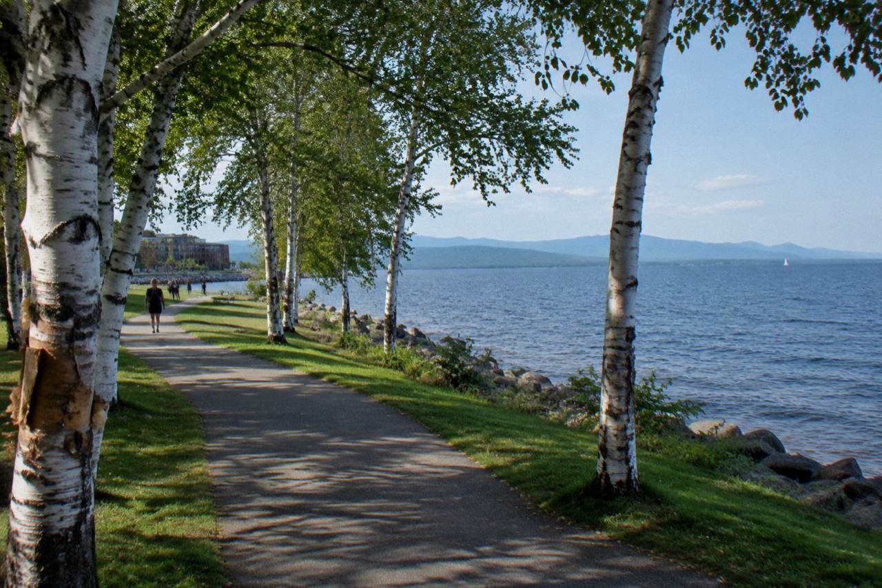
The Burlington bike path is an eight mile ribbon of pavement that never strays far from Lake Champlain, running from Oakledge Park in the south to the Winooski River at the city line. It is the urban spine of a much longer riding story: the Island Line, a 14.4 mile corridor that carries cyclists out of the city and onto the crushed gravel causeway, about five miles, that runs out across open water toward the Champlain Islands. On a clear October afternoon, with the Adirondacks stacked along the western horizon, it is one of the most rideable waterfronts in New England, and you can cover the whole thing on a rented bike without ever touching a road.
This guide covers the route and its endpoints, the surface changes you will hit north of the city, where to park, where to rent bikes right on the path, the e-bike rules, the bike ferry that bridges the causeway gap, where to stay near the riding, and who offers guided trips that use the path. Distances, hours and rules below come from Local Motion, the rail trail program and the trail managers themselves, and anything volatile is flagged so you know where to check before you ride.
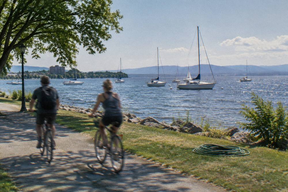
The Burlington bike path, formally the Burlington Greenway, is an eight mile paved multi-use path along the city's Lake Champlain shoreline, running from Oakledge Park on the south end to the Winooski River boundary on the north. It doubles as the southern segment of the Island Line corridor, which continues through Colchester and across the causeway toward South Hero for roughly 14.4 miles in total. Beyond the city limits the name changes but the riding continues: the Colchester Causeway portion is about five miles of compacted crushed stone built on an old rail bed that runs straight through the lake. Together the two pieces form one of the flattest, most accessible bike rides in Vermont, with lake views for nearly the entire distance. The path is a commuting route, a family riding corridor and a destination ride all at once, and it connects directly into the downtown waterfront, the parks system and the bike ferry link toward the islands. For planning a bigger trip around it, our overview of where to bike in Vermont places the path in context with the state's other signature rides.
The path's character changes block by block more than most visitors expect. Near the southern end it rolls through shaded parkland and past beaches; through the middle it runs hard against the working waterfront, with the marina, ferries and the Echo aquarium clustered in a mile-long stretch; and at the northern end it quiets down into the Delta Park and Winooski river mouth area, where the pavement hands off to the causeway approach. Because the grade never exceeds gentle rail-bed inclines, the whole corridor works for kids on balance bikes, e-bike riders and road cyclists doing intervals alike. There is a longer companion piece on the full corridor in our Island Line Trail biking guide if you want the end-to-end picture.
Practical riding starts at Oakledge Park in Burlington's south end and finishes at the Winooski River, where the path becomes the Colchester causeway approach, about eight miles later. Ambitious riders continue on crushed gravel across the causeway toward South Hero, which stretches the full Island Line journey to about 14.4 miles one way. The southern trailhead at Oakledge has parking, a beach and picnic areas, making it the friendlier start for families who want to ride out and back. The northern end connects toward the Colchester Causeway parking area, which is where most island-bound cyclists stage their ride if they want to skip the city miles. Because the corridor is effectively flat, doing the whole thing as an out-and-back from either end is a reasonable half-day bike ride for most riders.
Between those endpoints the path threads nearly every major waterfront landmark in the city. From south to north you pass North Beach, the Burlington Boathouse, the Echo Leahy Center on the waterfront, Waterfront Park, and the skate park and Community Sailing Center, all within a couple of hundred yards of the water. The path's role as a genuine transportation corridor matters for visitors too: hotels, the church street marketplace district and the ferry dock all sit within a short walk or roll. If you are planning a loop rather than an out-and-back, local riders often pair the path with low-traffic city streets to build a longer circuit, a routing approach covered in more depth in our Burlington bike path route detail.

| Segment | Surface | Approximate length | Character |
|---|---|---|---|
| Oakledge Park to the waterfront | Paved | about 3 miles | Parkland, beaches, gentle curves |
| Waterfront to Winooski line | Paved | about 5 miles | Marina district, docks, causeway approach |
| Colchester Causeway | Compacted crushed stone | about 5 miles | Open lake on both sides, no shoulders |
| Causeway gap crossing | Bike ferry or turnaround | short crossing | Ferry links the causeway to South Hero |
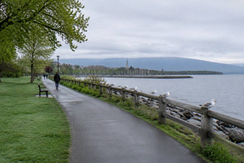
Inside the city the Burlington bike path is smooth asphalt the entire way, wide enough for two-way riding and friendly to road bikes, kids trailers and wheelchair users alike. The surface story changes at the causeway: roughly five miles of compacted crushed stone that is firm and rideable on almost any bike, but rattly on narrow road tires and occasionally loose after rain or in dry spells. Most riders on hybrid, gravel or mountain bikes notice nothing but scenery; riders on 25mm road tires report the causeway is doable but buzzy. The mainland portion of the corridor through Colchester alternates between paved path sections and the gravel causeway proper, so if you want pavement only, turn around where the stone begins. There is more on the gap and the crossing in our guide to the Colchester Causeway and Champlain Islands bike ride.
The other surface factor is seasonal. Fall brings leaf litter on the paved miles, which turns slick after rain, and the gravel causeway drains slowly after storms. Winter brings snow and conditions that vary year to year, and the state's rail trail pages, including the official Lamoille Valley Rail Trail information site, are the model for how these corridors post conditions; for this path, rider reports and the city's greenway pages are the fastest signal. A sensible rule for any long lakefront ride in Vermont: check trail status before a long ride, especially after weather.
| Bike type | Paved Greenway | Gravel causeway | Notes |
|---|---|---|---|
| Road bike, narrow tires | excellent | passable but buzzy | firm stone, expect vibration |
| Hybrid or touring bike | excellent | excellent | the natural choice for the full corridor |
| Gravel or mountain bike | excellent | excellent | most comfortable on stone |
| Kids bike or trailer | excellent | doable | slower riders on a narrow causeway |
| E-bike, Class 1 | permitted | permitted | throttle e-motos are not permitted |
Parking clusters at three practical points: Oakledge Park at the southern trailhead, the downtown waterfront lots near College and Lake Streets in the middle, and the Colchester Causeway lot at the northern end for riders targeting the lake crossing directly. Each carries different tradeoffs in cost, filling time and how much path you have left to ride. The waterfront lots are the most convenient for a hotel-free day trip and put you at the midpoint of the corridor, but they fill first on summer weekends and foliage Saturdays. Oakledge spreads the demand out and pairs parking with a beach and restrooms. The Colchester lot is the play if your whole goal is the causeway and you would rather bank those city miles.
A few planning habits make parking painless. Arrive before mid-morning in July, August and peak foliage weeks, or aim for weekday mornings when commuter bike traffic is up and car traffic is light. Cyclists staging a one-way ride often park at one end and use the path's flat profile to plan an out-and-back at a conversational pace. Nothing about parking on this corridor requires reservations, and the lots all sit within a short roll of the path itself, so the bike never needs to touch a road until you choose to.
| Parking area | Position on corridor | Best for | Watch for |
|---|---|---|---|
| Oakledge Park | south end | family rides, beach finish | limited shade lot capacity midday |
| Downtown waterfront lots | middle | hotel guests, short rides | fills on summer and foliage weekends |
| Colchester Causeway lot | north end | causeway and islands rides | gravel begins shortly after |
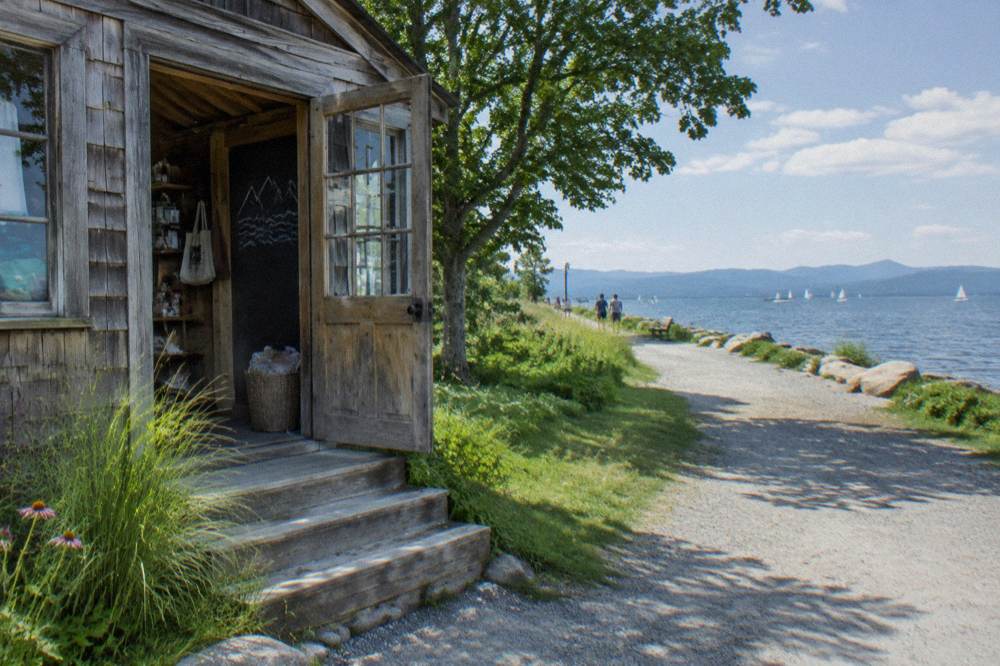
The single most convenient rental operation is the Local Motion Trailside Center at 1 Steele Street, sitting directly on the path in Burlington and open daily from 9am to 6pm, renting conventional bikes, Class 1 e-bikes, adaptive cycles and kids bikes, with reservations recommended. Local Motion is a nonprofit, and rental proceeds support its trail and bike education work, which is why the shop doubles as an advocacy hub. Rental prices are not verified here, so treat the listing as the source of record for current rates. Riders under 18 are generally restricted from the e-bike rentals per the shop's policies, and reservations are worth making in foliage season, when the waterfront draws big weekend crowds. There is a fuller rundown of options in where to rent bikes for the Burlington bike path.
The Trailside Center's on-path location matters more than it sounds. You can start riding the moment you roll out the door, skip car logistics entirely, and return the bike steps from the downtown hotels and the church street district. For adaptive riders, the shop rents adaptive cycles alongside its conventional bikes, Class 1 e-bikes and kids bikes. Details on hours, the fleet and the nonprofit's waterfront advocacy are on the Local Motion site.
Yes, in season. The Local Motion bike ferry crosses the gap in the Colchester Causeway that separates the riding corridor from South Hero, operating roughly late May to mid October on a donation basis, with a suggested five dollars one way. For the current season the ferry is closed, and it returns in May, so anyone planning a full island crossing should verify the schedule with Local Motion before committing to the ride. The gap exists because a channel was left open for boat traffic, and the ferry, a small pontoon barge crewed by seasonal staff, shuttles cyclists and walkers across in minutes. Without it, the causeway is a spectacular out-and-back dead end.
The practical implication for planning: the ferry's season brackets the best riding weather, but its fall schedule tightens to weekends in September and October, and shoulder-season weekday riders often find the crossing unavailable. The current season status, schedules and fare details are published on the Local Motion bike ferry page, which is the definitive source. Riding the causeway itself, about five gravel miles with open water on both sides, remains one of the signature bike experiences in the state even if you turn around at the gap: there is nothing else in Vermont where you pedal a rail bed through the middle of a lake.
| Crossing question | Answer |
|---|---|
| What does the ferry connect | the causeway gap to South Hero |
| Season | roughly late May to mid October |
| Cost | donation based, about $5 suggested one way |
| Current status | closed for this season, returns in May |
| Where to verify | the Local Motion bike ferry page |
Yes, Class 1 pedal-assist e-bikes are permitted on the Burlington Greenway and the Island Line corridor wherever bicycles are allowed, while throttle-driven e-motos and motorcycles are prohibited. The state's three-class e-bike framework treats Class 1 and Class 2 bikes as bicycles up to 20 mph assistance and Class 3 up to 28 mph, and the Local Motion rental fleet on the path is Class 1 only. That makes the corridor one of the friendliest e-bike rides in Vermont: flat, paved in the city, and socially mixed enough that assistance speeds feel natural. The gravel causeway is equally open to Class 1 machines, and e-assist is a genuinely good tool there, since the crushed stone surface adds rolling resistance that a motor smooths out.
Two cautions round out the picture. First, the same permissive rules do not apply everywhere in Vermont: e-bikes are currently prohibited on non-motorized natural-surface trails on state land, per the Vermont Mountain Bike Association, so the Greenway's openness is corridor-specific rather than statewide. The VMBA's state land e-bike policy page tracks that rule and any changes to it. Second, the causeway is narrow with no shoulders, so e-bike riders should hold modest speeds and call out passes, exactly as on any shared multi-use path. For the full rules picture, including where e-assist works across the state, see our guide to Vermont e-bike and helmet rules.
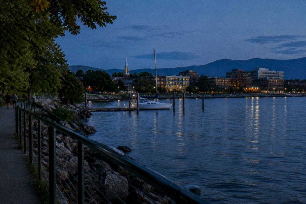
The best-positioned lodging sits within a short walk of the waterfront lots in downtown Burlington, which puts the path, the rentals at the Trailside Center and the ferry dock all in one car-free footprint. Riders who want the causeway and islands can also stage from the north, while Stowe-based riders treat Burlington as a day trip from the east. Location matters more than usual here because the path is flat and linear: a hotel at the waterfront means you can ride the whole corridor door to door, whereas a hotel in the suburbs reintroduces car logistics. The Hotel Champlain Burlington, Curio Collection by Hilton sits steps from Waterfront Park and the path access, and its listing includes free bicycle rentals, an unusual perk for a city hotel. The Hotel Vermont is about 0.2 miles from the path in the lake-side downtown, close enough that the bike comes out of the room and onto the Greenway in minutes.
Burlington, near Waterfront Park
Steps from Waterfront Park and the bike path access; its listing includes free bicycle rentals.
Check ratesFor riders building a wider Vermont biking trip, a second base can pay off. The Sun & Ski Inn And Suites in Stowe anchors the Stowe Recreation Path and the road loops around that village, pairing naturally with a Burlington day: the two riding areas are different enough that a split trip feels like two vacations. Whichever base you choose, book waterfront rooms early for foliage season, when the lake-view properties around the path fill first.
Guided riding out of Burlington is modest but real: Local Motion rents bikes from its Trailside Center on the path, and VBT Bicycling Vacations runs guided and self-guided trips that include the Champlain Valley. Booking for any operator is done directly with the operator itself. This site lists and sells no tours; what follows is a map of who exists so you know what to search for. VBT Bicycling Vacations builds multi-day itineraries around the state and its operator site carries the current trip lineup, including anything that rides the Champlain shoreline. Great Bike Tours, Lamoille Valley Bike Tours and Vermont Mountain Bike Tours also operate in the region and can be contacted directly.
What a guided option adds on this corridor is interpretation and logistics rather than difficulty: the path is flat and self-navigable, so the value is in natural history, lake context and not thinking about bikes, ferries or timing. A sensible middle path many visitors take is a self-guided day on the Greenway using Trailside Center rentals, then a separate guided multi-day trip elsewhere in the state. Our how to choose a Vermont bike tour guide walks through the questions worth asking any operator before you commit, from group size to bike type to what support actually means on a given itinerary.
| Option | Who runs it | Best for | Booking |
|---|---|---|---|
| Path rentals plus self-guided riding | Local Motion Trailside Center | families, short visits, flat-corridor days | direct with the shop |
| Multi-day guided trips in Vermont | VBT Bicycling Vacations | riders wanting full logistics support | direct with the operator |
| Regional guided trips | Great Bike Tours, Lamoille Valley Bike Tours, Vermont Mountain Bike Tours | itinerary variety, local knowledge | direct with each operator |
The corridor is rideable from snowmelt to snowfall, but the two standouts are early summer, when the waterfront is fully awake and the ferry is running, and foliage season, when color typically runs late September to mid October with ridgelines turning earlier and lake-moderated valleys later. October averages a high near 56 and a low near 36, with sunrise close to 7 and sunset near 6:20, so plan rides midday for warmth and light. Fall deserves its reputation here. The lake holds heat longer than the hills, the path's maples and oaks peak after the mountains have turned, and riding a lakeside trail at color peak with empty morning paths is as good as Vermont biking gets. The tradeoff is that foliage weekends bring the year's biggest crowds to the waterfront lots, so midweek mornings are the connoisseur's window.
Spring and shoulder-season riders get their own rewards: empty paths, migrating waterfowl on the lake and the causeway in moody weather. Summer is the full-production season, with the ferry running daily schedules, the beaches busy and the Trailside Center's rental fleet in highest demand. Whenever you go, layer for the lake breeze, which cools the corridor even on warm inland afternoons, and check trail status before a long ride, since flood repairs and maintenance touch these corridors in any season. Our best time to bike in Vermont guide extends this calendar statewide.
| Season | Path conditions | Ferry | Crowds |
|---|---|---|---|
| Late spring | clear, cool, occasional mud | begins late May | light |
| Summer | dry, busy, full services | daily schedules in season | heaviest weekends |
| Fall foliage | dry, leaf litter after rain | weekends into mid October | heavy foliage weekends |
| Late fall to winter | variable, snow possible | closed after mid October | minimal |
The Burlington bike path is the flattest and most accessible of Vermont's headline riding corridors: eight paved city miles, with gravel options north, versus the 95 mile Lamoille Valley Rail Trail, the 100-plus mile singletrack network at Kingdom Trails, and the mountain riding around Stowe. It is the only one that pairs a lake crossing with an urban base. That makes it the right first ride for visitors, the right base camp for families, and a useful warmup before bigger commitments like a rail trail tour or a mountain bike weekend in the Northeast Kingdom. The LVRT, the longest rail trail in New England at 95 miles from St. Johnsbury to Swanton, shares the flat rail-bed character but trades lake views for farm country and river valleys; our Lamoille Valley Rail Trail biking guide covers it in full. Kingdom Trails, by contrast, is purpose-built singletrack requiring a pass, a different proposition entirely that our Kingdom Trails mountain biking guide breaks down.
Thinking of the state's riding as a menu helps: Burlington for flat, urban, lake-crossed riding; the Northeast Kingdom for mountain biking; the LVRT for long-distance gravel touring; the Stowe area for recreation path family riding mixed with mountain climbs. Vermont Biking Tours exists to help you choose between exactly these options, and the path is the most forgiving entry point among them. Many riders combine two: a Burlington city ride plus a Kingdom Trails weekend is the classic pairing.
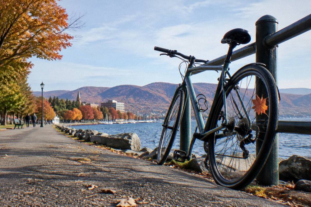
For visitors who fall for the waterfront and want to linger, the lodging picture from earlier still holds as the decision that shapes the ride. Staying right in the lake-side downtown keeps the Greenway, the Trailside Center and the evening waterfront within a short walk, which is why the downtown properties along the corridor book out first on foliage weekends. Among them, the Hotel Vermont is the closest full-service option to the path at about 0.2 miles, a distance that reads as a two minute roll with a bike in hand.
Burlington, 0.2 miles from the Burlington Bike Path
About 0.2 miles from the Burlington Bike Path in the lake-side downtown.
Check ratesThe Burlington Greenway segment is about 8 miles of paved path from Oakledge Park to the Winooski line. Continuing onto the Colchester Causeway toward South Hero stretches the full Island Line journey to roughly 14.4 miles one way.
It starts at Oakledge Park on the south end of the city and ends at the Winooski River, where it connects toward the Colchester Causeway and the Champlain Islands. Most family rides use the waterfront miles in the middle.
Yes. The Local Motion Trailside Center at 1 Steele Street sits directly on the path and rents conventional, Class 1 e-bike, adaptive and kids bikes daily from 9am to 6pm, with reservations recommended. Check the shop for current rental prices.
Class 1 pedal-assist e-bikes are permitted wherever bicycles are allowed on the Greenway and Island Line corridor. Throttle e-motos and motorcycles are prohibited, and the Local Motion rental fleet is Class 1 only.
The ferry operates roughly late May to mid October on a donation basis, but it is closed for the current season and returns in May. Check the Local Motion bike ferry page for the schedule before planning a full island crossing.
Yes, it is one of the best beginner bike rides in Vermont: flat, paved, car-free and punctuated by beaches, parks and restrooms. The gravel causeway is rideable for confident kids but is narrow with open water on both sides.
Before you go, the pick for this guide:
Hotel Vermont
About 0.2 miles from the Burlington Bike Path in the lake-side downtown.
Check rates →