What Is The Prettiest Place In Vermont?
Scenic Vermont regions ranked as ride settings for cyclists, from the Champlain lake shore and Stowe valley to the Northeast Kingdom, with trail facts and where to stay.
Beauty By Ride Type
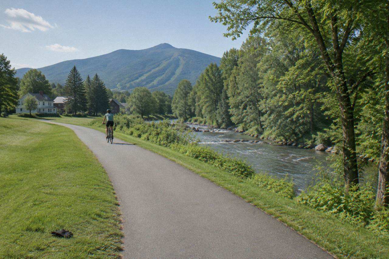
No single place wins, because Vermont's beauty sorts by ride type: the Champlain lake shore around Burlington and the Colchester Causeway is the prettiest flat water ride, the Stowe valley and Smugglers' Notch road is the prettiest paved climb, and the Northeast Kingdom around East Burke is the prettiest forest riding in the state. Each region earns the title for a different kind of cyclist.
The honest answer to this question is that Vermont is too small and too varied for one winner. The whole state is roughly the size of a single county in a western state, yet it holds a great lake, two mountain ranges, a chain of rural rail trails and one of the most ridden mountain bike networks in the country. Ask a road rider and a fat biker the same question and you get opposite halves of the map.
What this guide can do is compare the scenic regions the way a cyclist actually experiences them: by surface, gradient and what you see from the saddle. A view you pedal past at twelve miles an hour registers differently from one you drive past at sixty. The prettiest place in Vermont, for a person on a bike, is the place whose beauty matches the machine you brought.
The biking case for each region follows, with the trail facts that shape the ride. Where a number matters, it comes from the trail managers and state agencies that publish it. For timing the trip around color, the companion guide on Vermont fall foliage peak dates by region breaks the season down county by county.
Why Does The Northeast Kingdom Top So Many Lists?
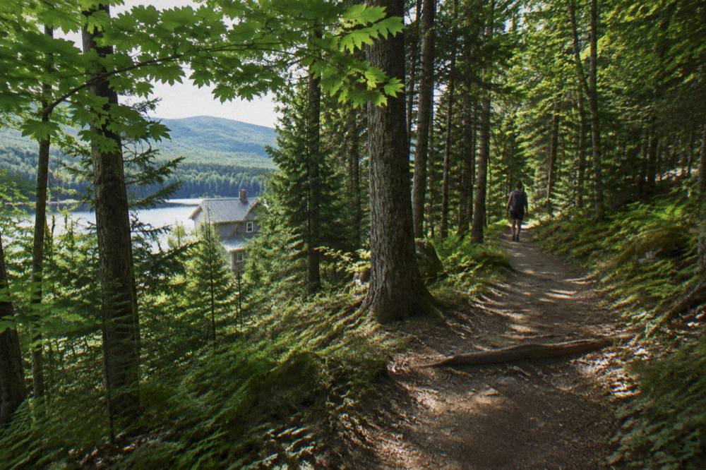
The Northeast Kingdom, the forested corner around East Burke and Lyndonville, earns its reputation through density: Kingdom Trails alone lists over 100 miles of non-motorized singletrack and multi-use trail across 213 named routes, all of it threading working farms and maple woods. No other region puts that much rideable scenery in one small area, and the network closes only for late autumn hunting before reopening for winter fat biking.
The Association that manages the network publishes a Ride With Gratitude ethos, because nearly every trail crosses private land that landowners keep open by choice. That arrangement is itself part of the scenery: you ride through pastures with dairy cows, past sugarhouses and down into dark spruce hollows, sometimes within a single descent. The summer season runs when conditions allow, typically from May to the end of October, and the Kingdom Trails Association sells passes online or at the Welcome Center on Route 114 in East Burke.
Photographers rate the Kingdom highly for the same reason riders do: the hills are low and folded, so color arrives early and the light moves all day. In autumn the region turns early, with peak color typically arriving in late September to early October, ahead of the southern valleys. Riders report that the mixed hardwood and softwood stands hold their leaves well even after the maples drop. If that early window sounds appealing, our guide on timing foliage season across Vermont's regions explains how the peak shifts from north to south.
The practical riding notes are simple. Passes are required, and current pass prices live on the Association's store page rather than on any static listing, so check there before budgeting. Class 1 pedal-assist eMTBs are allowed on most trails per the Association, with the trail map flagging landowner exclusions. Shops at the trailhead, including East Burke Sports and Kingdom Bike Rentals, handle rentals and repairs, though rental pricing is published by each shop directly.
Is The Champlain Valley The Prettiest Flat Riding?
For pure water scenery, yes: the Island Line Trail runs about 14.4 miles from the Burlington waterfront toward South Hero, including roughly 5 miles of crushed gravel causeway riding across the open lake, one of the few places in New England where a bike path leaves the shore behind completely. The Burlington Greenway portion, about 8 miles of paved path, strings the whole lake front together.
The causeway is the section people photograph. Built on a former rail bed, it runs dead straight through the lake with water on both sides, and on a clear day the Adirondacks sit on the horizon to the west while the Green Mountains rise behind you. The path is flat the entire way, which makes it one of the most accessible scenic rides in the state for beginners, families and riders on adaptive cycles.
There is one operational fact to know. A gap in the causeway at the Colchester line is bridged in season by the Local Motion bike ferry, which runs roughly late May to mid October on a donation basis; the ferry is closed for the current season and returns in May, and the ferry page carries the schedule. Outside ferry season, riders turn around at the gap and still get the best of the views.
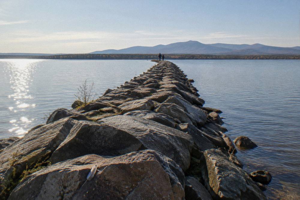
The same shore holds a second scenic argument: sunsets. Because the path faces west across open water, the evening light over the lake is a consistent draw, and the waterfront parks in Burlington give the ride a cafe-and-bakery finish that the mountain regions cannot match. Riders who want a deeper look at the route can read the companion piece on Colchester Causeway and the Champlain Islands bike ride.
Local Motion, the nonprofit that runs the ferry, also operates the Trailside Center at 1 Steele Street in Burlington, right on the path, renting conventional, Class 1 e-bike, adaptive and kids bikes with reservations recommended. That makes this the easiest region in the state to arrive empty-handed and still ride.
What Makes The Stowe Valley So Photogenic?
Stowe pairs a postcard village with the state's most dramatic paved climb: Mountain Road rises through Smugglers' Notch, where the highway squeezes between cliffs and giant boulders, and the Stowe Recreation Path runs about 5 miles of traffic-free path alongside the West Branch river through meadow and woods. Few towns offer both a family path and an alpine notch within one ride of each other.
The Recreation Path is the town's scenic spine. It crosses the river on wooden bridges, passes swimming holes and ends near the base of the mountain, and it is flat enough for mixed groups. Road riders use it as a warm-up before taking Mountain Road up into the Notch, where the road curls through boulders the size of buses and the temperature drops with the elevation. In fall the notch is one of the earliest places in the region to turn, because altitude advances the color.
Stowe also serves as a hub for the Lamoille County road loops, quiet farm roads that roll between barns and corn land. The riding is gentler than the notch suggests, and the village density of inns and bakeries makes it one of the easiest towns to base in without a car. A stay at Sun & Ski Inn And Suites puts the Recreation Path and the village loops at the door, which is the whole point of choosing Stowe: the ride starts where you sleep.
Where Does Woodstock Fit In The Scenic Ranking?
Woodstock is the prettiest village-scale setting in the state for cyclists, because its riding is built around two historic landscapes: the Mount Tom carriage roads, dirt lanes through woods and field that ban cars, and a set of gravel loops that fan out from the village into the surrounding hills. The town itself, with its green, covered bridge and brick storefronts, sits in the middle of the loop like a designed finish line.
The carriage roads on Mount Tom are the quiet gem. They are multi-use dirt roads, gentle of grade, and they deliver long views over the Ottauquechee Valley without a single stretch of highway shoulder. Gravel riders extend the same day onto class 4 roads and forest tracks that climb to ridgeline pastures. Because the terrain is rolling rather than mountainous, Woodstock suits riders who want scenery per hour more than vert per ride.
For a stay built around the riding, the Woodstock Inn & Resort sits in the village itself and serves as the natural base for the gravel loops and the carriage roads. That placement matters in a region where trailheads and climbs are all within a short pedal of the green. The scenic payoff is compact: everything photographable about Vermont villages is within one ride loop.
Comparing the regions side by side helps, because each one wins a different column:
| Region | Signature ride | Surface | Scenic character | Best bike |
|---|---|---|---|---|
| Champlain Valley, Burlington and South Hero | Island Line Trail and Colchester Causeway, about 14.4 miles | Paved path plus crushed gravel | Open lake, mountains on both horizons, sunsets | Any bike, including rental and adaptive |
| Northeast Kingdom, East Burke | Kingdom Trails network, 100+ miles | Singletrack and multi-use dirt | Forest, farms, sugarbush, early foliage | Mountain bike or Class 1 eMTB |
| Stowe | Recreation Path plus Mountain Road and the notch | Paved path and paved road | Village, river meadows, cliff-walled notch | Hybrid or road bike |
| Woodstock | Mount Tom carriage roads and gravel loops | Dirt roads | Village green, covered bridge, pasture ridgelines | Gravel or hybrid |
| Lamoille Valley | Lamoille Valley Rail Trail, 95 miles | Compacted crushed stone | River valley, 18 towns, farmland | Hybrid, gravel or e-bike |
Is The Lamoille Valley Rail Trail The Prettiest Long Ride?
For distance scenery, the Lamoille Valley Rail Trail is the strongest single answer in the state: 95 miles of compacted crushed stone from St. Johnsbury to Swanton through 18 towns, the longest rail trail in New England, following the Lamoille River through valley farmland the whole way. The grade stays under 3 percent, so the scenery arrives without effort, and the trail is open year-round to non-motorized use.
The state's rail trail program, which manages the route, allows e-bikes along the whole corridor and permits snowmobiles only in the winter club season, which keeps the summer experience quiet. Riders describe the middle sections, around the towns of Hyde Park and Cambridge, as the most pastoral, with the river staying close and the hills forming a wall on either side. Because it is a rail bed, the trail never climbs steeply, and the firm compacted surface suits everything from hybrid tires to loaded touring setups.
The practical advice is to ride it in segments rather than attempt the whole distance, and to check trail status before a long ride, since flood repairs and occasional trailhead work close short pieces during the season. The official rail trails site publishes updates and the plan-your-trip breakdown of access points. A rider choosing between this and the Champlain shore is really choosing between river scenery and lake scenery, and both are flat, both are family-friendly, and both reward an e-bike.
When Is Vermont At Its Most Beautiful?
Late September to mid October is the scenic peak, with the state turning in waves: the northern Northeast Kingdom and the ridgelines color first, the central Green Mountains and valleys follow, and the southern lowlands finish last. That stagger means the prettiest place shifts week by week, and a rider who times it right can chase peak color downhill across a single trip.
The pattern repeats reliably each year even though the exact days move. The Kingdom's high ground colors about a week ahead of the central valleys, and ridgelines run ten days to two weeks ahead of valley floors. October riding weather averages a high in the mid fifties and a low in the mid thirties Fahrenheit, with sunrise near seven and sunset not long after six, so the golden hours stretch long across the landscape and the mornings want layers.
The foliage crowd is real, especially on the famous numbered roads, but bikes sidestep most of it. Leaf-season drivers concentrate on a few scenic byways, while the rail trails, the causeway and the Kingdom's dirt stay comparatively calm, particularly midweek. Riders should also note that many rural roads are narrow with limited shoulders, standard for Vermont secondary roads, so route choice matters more in October than in July. The guide to the best time to bike in Vermont covers the full season trade-offs, including summer lake riding and the winter fat bike network.
Which Region Should A Mountain Biker Choose?
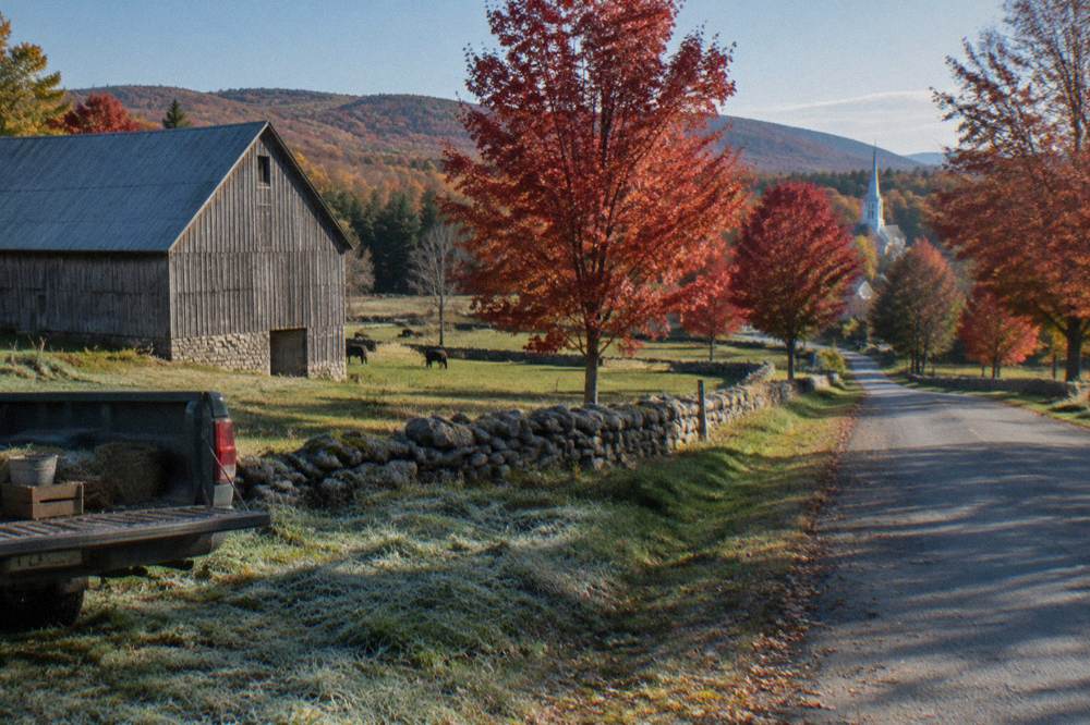
A mountain biker should choose the Northeast Kingdom, and it is not close: the East Burke network is the most extensive and best known mountain bike destination in the state, with over 100 miles of singletrack and multi-use trail across varied terrain, plus a winter fat bike season on groomed singletrack that keeps the region rideable all year. Woodstock and Stowe offer dirt riding, but neither matches the scale.
The winter detail matters more than visitors expect. When the summer trails close in late autumn for the deer hunting season, the Association grooms designated trails for fat bikes with tires wider than three and a half inches, alongside its Nordic ski network, and the East Haven area closes to winter use entirely. That makes the Kingdom one of the few Vermont destinations where the scenic riding never fully stops, just changes tires.
E-bike riders should check the rules by landowner. Class 1 pedal-assist eMTBs are allowed on most Kingdom trails per the Association, with the trail map listing exclusions, while on state land the policy is narrower: e-bikes are currently prohibited on non-motorized natural-surface trails and allowed on roads and multi-use paths, per the Vermont Mountain Bike Association, with a policy expansion proposed but not confirmed. The same distinction shapes the rail trails, where e-bikes are welcome, and it is worth reading the site's guide on e-bike rules in Vermont before bringing a motor.
Where Should You Stay To Wake Up In The Scenery?
The lodging answer follows the riding answer: stay in the village closest to your chosen surface, because Vermont's scenic regions are small enough that a well-placed base removes driving entirely. In the Kingdom, an inn on the Burke side of Lyndonville puts singletrack within a short pedal; in Burlington, a hotel near the waterfront puts the lake path outside the door; in Woodstock and Stowe, village inns sit at the center of the loops.
In the Kingdom, the riding-first choice is The Wildflower Inn, 2.3 miles from Kingdom Trails, which offers bike rentals and a bicycle shuttle so guests can move between trailheads without loading a car. That shuttle detail is the difference between a riding trip and a driving trip in a region where the best trailheads fill early in leaf season. For the lake shore, the hotels near Waterfront Park and the Burlington Bike Path put the Greenway, the causeway and the ferry within the same flat ride.
The Wildflower Inn
Lyndonville, 2.3 miles to Kingdom Trails
Offers bike rentals and a bicycle shuttle, and sits 2.3 miles from Kingdom Trails.
Check ratesThere is also a case for splitting a week. Vermont is compact enough that two bases, one lakeside and one in the hills, cover both the flat water scenery and the forest riding without more than a couple of hours of driving between them. Riders building that kind of trip will find the round-up of the best bike rides in Vermont useful for pairing routes by region.
Can You See The Prettiest Places On A Multi-Day Trip?
Yes, and a bike is the right way to do it: a week-long trip can link the Champlain shore, the Lamoille Valley Rail Trail, Stowe and the Northeast Kingdom in one arc, because the distances between them run 30 to 60 miles of rideable terrain rather than a full day's drive. Multi-day riders either self-support on the rail trail corridor or book an inn-to-inn trip with an operator that moves luggage between villages.
The self-guided version is well suited to the rail trails, since the LVRT's 18 towns include places with inns and food, and the surface is firm and flat enough to carry loaded bikes. The supported version suits the road and gravel regions, where operators such as VBT Bicycling Vacations run guided and self-guided trips with luggage transport, booked directly with the operator. Riders comparing the two styles can read the site's breakdown of guided versus self-guided bike trips in Vermont.
Timing a multi-day trip is the one genuinely hard decision, because the foliage peak moves while you ride toward it. Late September favors a Kingdom-first route, riding south as the color follows; mid October favors reversing the order and ending on the lake shore, where the valleys hold color latest and the sunsets close the trip. Either direction works, and this site's whole premise, that Vermont Biking Tours is a guide to riding the state rather than driving past it, rests on that kind of planning.
For riders whose answer to the prettiest-place question is Woodstock, the village-base option bears repeating: the carriage roads and gravel loops all radiate from the green, so a single inn in the middle of town replaces the morning drive entirely. That arrangement is rare among Vermont's scenic regions, and it is the reason the village earns a place on this list beside the bigger networks.
Woodstock Inn & Resort
Woodstock village
The village base for the Woodstock gravel loops and the Mount Tom carriage roads.
Check ratesCommon Questions About The Prettiest Place In Vermont
What Is The Prettiest Place In Vermont?
It depends on what you ride: the Champlain lake shore and Colchester Causeway for flat water scenery, Stowe and Smugglers' Notch for paved mountain drama, Woodstock for village and carriage-road charm, the Lamoille Valley Rail Trail for long river-valley distance, and the Northeast Kingdom for forest riding on more than 100 miles of trail.
What Is The Prettiest Bike Ride In Vermont For Beginners?
The Burlington Greenway and Island Line Trail, about 8 paved miles along the waterfront continuing onto the causeway, is flat, traffic-free and scenic from the first pedal stroke. The Stowe Recreation Path is the inland equivalent, running beside the river through meadows on gentle grades.
When Is Vermont At Its Most Scenic?
Late September to mid October, when foliage peaks in waves: the Northeast Kingdom and ridgelines first, the central valleys next, and the southern lowlands last. The stagger means peak color moves across the state for roughly three weeks.
Is The Northeast Kingdom Worth The Drive For Cyclists?
For mountain bikers, yes: Kingdom Trails is a riding network in the state, with over 100 miles of trail, seasonal passes sold online or in East Burke, and rental shops at the trailhead. In fall it is also among the first regions to reach peak color.
Can You Ride Between Vermont's Scenic Regions?
Largely yes. The Lamoille Valley Rail Trail links St. Johnsbury in the Kingdom to Swanton near the lake, and road corridors connect Stowe, Burlington and Woodstock at rideable distances. Many riders split the difference with two bases and short transfers between regions.
Are E-Bikes Allowed On The Scenic Vermont Trails?
Yes on the rail trails, including the full Lamoille Valley corridor, and Class 1 pedal-assist eMTBs are allowed on most Kingdom Trails routes per the Association's map. On state land, e-bikes are currently limited to roads and multi-use paths rather than natural-surface singletrack.